The unique and interesting Mawrth Vallis is one of the best places on Mars to look for signs of life! Yes, you have heard it right. If you are interested in knowing what they are, and how they would help scientists with further studies, and discoveries, we have got you!
So, keep track of us, and let’s start our blog.
The Martian Dichotomy Border Revealed by Mawrth Vallis!

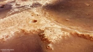
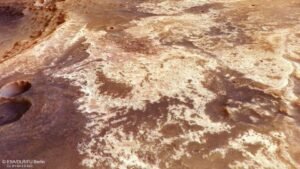
ESA’s Mars Express went back to a favorite spot, which is the unique and interesting Mawrth Vallis. This part of Mars has been photographed by Mars Express before. In 2016, a big mosaic of Mawrth Vallis was made from data collected by the spacecraft, along with an animation of the area. Like this new picture, these were made using data from the Mars Express High-Resolution Stereo Camera (HRSC).
Capturing images of the same region of the planet at various intervals holds significant importance, not just for enhancing our Mars models and mosaics, but also for monitoring alterations on its surface, be it seasonal variations or otherwise. Additionally, this practice helps mitigate the impact of dust clouds in the Martian atmosphere, which can pose challenges to accurate mapping endeavors.
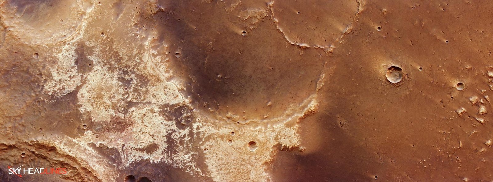
This image notably captures the Martian dichotomy border of Mawrth Vallis. A prominent ridge encircling Mars distinctively separates the southern highlands from the northern lowlands. The difference in height between the two hemispheres can be up to 3 km, which is a lot. This border goes straight (and almost diagonally) through this picture, which you can see best on the topographical and context maps that go with it.

But how they tell us about early life, and its signs, let’s it out in the next paragraph.
Could Mawrth Vallis on Mars Hold Clues to Ancient Life?
Mawrth Vallis is thought to be a very good place to look for past or present life on Mars. Due to this, it was chosen as one of the two best places for the ExoMars Rosalind Franklin rover to rest. It came in second place to Oxia Planum, which is close and will tell us more about the history of water and, by extension, life in this part of Mars.
The area is covered in a thick layer of light-colored clays with silicate minerals. These deposits, which can be up to 200 meters deep in some spots, are the most common on Mars and can be seen in these new images (and are clearest in the version with annotations). The dark “caps” on top of the light clays are thought to have come from volcanoes.

Along with HRSC, Mars Express has used its spectrometer (OMEGA) to figure out what the clay materials here are made of and found that they have a lot of iron, magnesium, and aluminum. Clay rocks, requiring water for their formation, serve as a distinct indicator of abundant water presence in this location during earlier times. We know that around 3.6 billion years ago, liquid water did flow through Mawrth Vallis.
Could some microbes from this time still be in the rock, safe from radiation and erosion, waiting for astrobiologists to find them?
Mars’ Geological Mysteries Mawrth Vallis Unfold Discoveries from New Pictures!

These new pictures show interesting things. The topographic map shows that the ground on the left side of the main picture is much higher than the ground on the right. It is also older and has more wear and tear. It is dominated by a big 25 km-wide impact crater with a partially collapsed wall and a smaller crater in the middle (a central pit). Central pits could mean that there is buried ice that melts during the impact and causes the surface above to fall.
In the middle of the picture, to the right of the center pit crater, you can see big spots of light-colored clay. In the walls of some of the holes here, you can see clays mixed in with caps of dark volcanic rock. Apart from this, let’s have a glance at some of the keen details of the pictures, and what they revealed.
Exploring Mars’ Dynamic Landscapes
As you move to the right (north), the land gets smoother and lower. This is where the lowlands of Mars start. More specifically, is the beginning of a plain called Chryse Planitia. On this line, two big, highly eroded craters are connected.

The wider one is about 75 km, while the narrower one is about 35 km. Mars’ Chryse Planitia is a very interesting place. In the past, the MARSIS radar on Mars Express found ancient basins here that were sunk hundreds of kilometers below the surface.
Several ‘mesas’ and ‘knobs’ (small hills) about 3 km across are scattered across the northernmost land (to the right) if we look deeper into the Mawrth Vallis, and are near these craters. Last but not least, the top right corner of the picture shows proof of an earlier impact. This hit sent out a mix of water, rocks, and other debris that moved like mud and covered the surface like a blanket.
Would it be helpful in further findings and discoveries? If yes, then how? Let’s uncover some secrets in the following parts.
What Mars Express HRSC Mission Revealed?

Since 2003, Mars Express has been going around and around the Red Planet. It is capturing images of the Martian surface, Mawrth Vallis creating detailed maps of its materials, analyzing the composition of its thin atmosphere and its atmospheric movements, conducting drilling operations into the planet’s crust, and exploring the interactions and dynamics within the Martian environment.
The HRSC, which took these pictures, has shown us a lot about Mars’ varied surface in the past 20 years. Its pictures show ridges and lines made by the wind, sinkholes on the sides of huge volcanoes, impact craters, tectonic faults, river channels, and old lava pools.

The mission has been very successful, giving us a much fuller and more accurate picture of our neighboring world than we ever had before.


