
NASA launched the Aqua satellite in 2002 as part of the Earth Observing System to monitor Earth’s water cycle comprehensively. Intended for a six-year mission, Aqua has far exceeded expectations, continuing to provide critical data for over two decades. This article explores Aqua’s contributions, including a recent significant observation of the Gulf of Alaska, and looks ahead to the upcoming PACE mission.
What is the Aqua satellite used for?
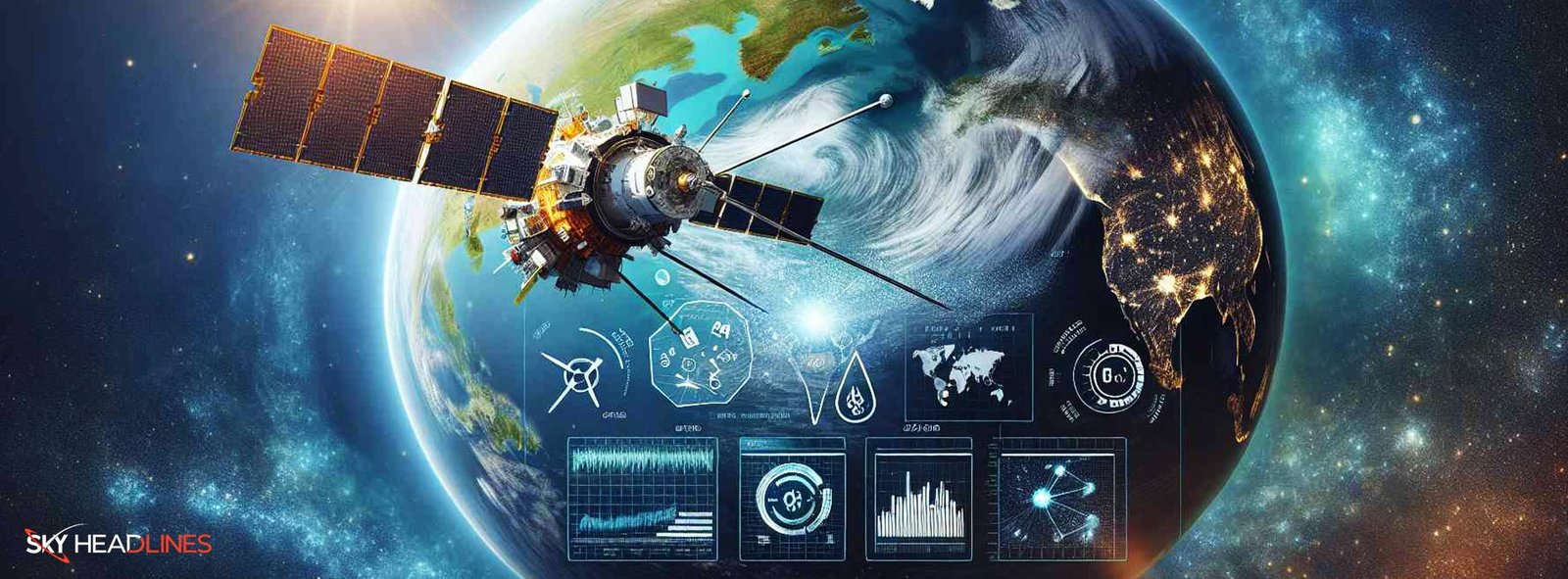
The Aqua satellite was developed to advance our understanding of Earth’s water cycle and environment. It carries six distinct instruments designed to study the precipitation, evaporation, and cycling of water. The satellite’s main goals encompass collecting data related to the Earth’s water cycle, which includes monitoring alterations in ocean evaporation, atmospheric water vapor, precipitation, soil moisture, sea ice, and land and ice snow cover. By achieving these objectives, the Aqua satellite plays a crucial role in improving the models of Earth’s climate and environmental change.
Instruments Onboard Aqua Satellite
The Moderate Resolution Imaging Spectroradiometer, also known as MODIS, offers precise data across a range of terrestrial, oceanic, and atmospheric characteristics, ensuring exceptional data quality. It measures cloud cover and processes, surface radiation budget, water vapor, land cover change, vegetation dynamics, and temperature.
Advanced Microwave Scanning Radiometer-EOS (AMSR-E): This instrument measures cloud properties, sea surface temperature, near-surface wind speed, precipitation, soil moisture, and snow cover. However, it ceased operation in 2011.
The Atmospheric Infrared Sounder (AIRS), Advanced Microwave Sounding Unit (AMSU), and Humidity Sounder for Brazil (HSB) collaborate seamlessly to deliver accurate information regarding atmospheric temperature and humidity, cloud formation, and greenhouse gas concentrations.
Clouds and the Earth’s Radiant Energy System (CERES) is a tool designed to gauge both the solar-reflected and Earth-emitted radiation spanning from the outermost layer of Earth’s atmosphere down to its surface.
Measurement of Pollution in the Troposphere (MOPITT): This instrument measures carbon monoxide and methane levels in the troposphere.
Key Contributions and Findings
The Aqua satellite has contributed significantly to the study of Earth’s environment. Several notable discoveries from Aqua’s research encompass the following:
Climate Change and Global Warming: Aqua’s invaluable data has played a pivotal role in investigating the impacts of global warming on the Earth’s water systems. It has offered compelling proof of escalating atmospheric temperatures, the depletion of polar ice, and the ascent of sea levels.
Weather Prediction: The data from the Aqua satellite has enhanced weather prediction models, leading to more accurate forecasting. This is particularly crucial for predicting natural disasters like hurricanes and floods.
Air Quality and Pollution: Aqua’s MOPITT instrument has been vital in monitoring air pollution levels worldwide, providing insights into the sources and dynamics of air pollutants.
Water Cycle Research: Aqua’s observations have contributed to an enhanced comprehension of the worldwide water cycle, offering valuable insights into precipitation patterns, evaporation processes, and the formation of ice and snow.
A Closer Look: The Gulf of Alaska
In December 2023, the Aqua satellite captured a striking image of the Gulf of Alaska. The photo showed a beautiful contrast between the turquoise waters, rich in glacial flour, and the snow-covered southern Alaskan coastline. This phenomenon, partly due to sediment from the Copper River and potentially phytoplankton, highlighted the complex interplay between geological and biological factors in ocean ecosystems.
The Role of Glacial Flour and Phytoplankton
Glacial flour, a fine silt produced by glaciers, imparts a unique turquoise hue to the water. Rich in nutrients, it can foster phytoplankton growth, crucial for the oceanic food chain. Despite their typically lower winter concentrations, phytoplankton contribute significantly to the ocean’s color diversity, as noted by Aimee Neeley, a biological oceanographer at NASA’s Goddard Space Flight Center.

What is the PACE mission?
The upcoming PACE (Plankton, Aerosol, Cloud, ocean Ecosystem) mission, scheduled for launch in February 2024, is set to build on Aqua’s legacy. PACE will focus on hyperspectral observations, enhancing our ability to distinguish different types of particulate matter in the ocean. This advancement is critical for assessing ocean health and understanding phytoplankton diversity.

The Future of Ocean Health Studies
PACE, equipped with advanced instruments, is expected to revolutionize our understanding of marine biodiversity. By analyzing phytoplankton, PACE will provide insights into marine ecosystems, crucial for future research and conservation efforts.
Challenges and Limitations
While the Aqua satellite has been a highly successful mission, it faces several challenges:
Aging Instruments: As the mission exceeds its expected lifespan, some instruments have stopped functioning, like the AMSR-E.
Data Management: The vast amount of data generated by the Aqua satellite poses significant challenges in terms of processing, analyzing, and storing information.
Conclusion
NASA’s Aqua Satellite has been a cornerstone in Earth observation, significantly enhancing our understanding of the planet’s water cycle, climate system, and environmental changes. The satellite’s long-standing contributions, coupled with the anticipation of the PACE mission, underline the importance of continuous observation and study of our planet. As Aqua continues to provide valuable data, it stands as a testament to the enduring value of space-based environmental research, opening doors to discoveries and a better understanding of our world.
FAQ
How does the Aqua Satellite contribute to climate change studies?
The Aqua Satellite provides essential data for climate change studies by monitoring global temperature patterns, atmospheric composition, and changes in sea ice and land surface water. These observations aid scientists in gaining a deeper comprehension of the Earth’s climate system and evaluating the consequences of human actions on the evolving climate of our planet.
What role does the Aqua Satellite play in weather forecasting?
The Aqua Satellite holds a crucial position in weather forecasting, as it supplies precise and timely information about atmospheric elements like temperature, humidity, and cloud cover. This data is invaluable to meteorologists, enabling them to enhance the precision of weather forecasts and strengthen early warning systems for severe weather occurrences.
How does the Aqua Satellite support disaster management efforts?
By monitoring Earth’s water cycle, tracking changes in sea ice, and providing detailed observations of land surface water, the Aqua Satellite contributes to disaster management efforts. Empowered by data, authorities can now proactively anticipate and strategically respond to natural disasters like floods, droughts, and hurricanes.
What are the prospects for the Aqua Satellite?
The Aqua Satellite continues to evolve and contribute to our understanding of Earth’s systems. Prospects include upcoming missions and projects that aim to enhance the satellite’s capabilities and expand its range of observations. Technological advancements, collaborations with other space agencies, and research initiatives hold promise for further unlocking the potential of the Aqua Satellite in advancing our knowledge of our planet and its climate.